
Mobility Data
modelling
Solutions
Smart solutions for data-driven urban infrastructures
Drive the urban mobility digital transformation.
Transform urban living with smart city solutions powered by live data insights. Leverage historical and live traffic data and predictive analytics to optimise infrastructure, reduce congestion, and enhance urban mobility.
Targa Telematics empowers city planners, traffic authorities, businesses, municipalities, and regional administrators with rich traffic analytics and mobility data, enabling them to make informed decisions that streamline transportation, improve efficiency, increase safety, and create sustainable, liveable environments for the future.
- Understand the main traffic flows, where they origin and where they are likely to end
- Improve the traffic flow at critical points such as junctions, squares, diversions, and similar
- Evaluate the danger of specific roads and reduce incidents
- Manage the traffic flows during events and special occasions
- Correctly size and place the parking and rest areas
- Measure the efficacy of your interventions
Solution highlights
Cost-Effective solutions
Efficient support of stakeholders involved in projects on sustainable urban mobility, road safety, preventative road interventions and infrastructure planning and deployment.
Leverage a broad range of reliable datasets to enhance reporting, traffic modelling, analysis, and the development of analytical tools – tailored to meet the specific goals of your research or application.
Rest easy with our GDPR-compliant, privacy-first approach, ensuring data security and anonymity.
Datasets
Targa Telematics harnesses multiple data sources, processing and enriching them to be licensed to third parties or presented through intuitive reports for smarter, more efficient decision-making. Vehicular data falls into two categories: live anonymised streams for short-term use and historical datasets for trend analysis and modelling, offering insights into traffic flow and seasonal patterns.
Data streams FCD
Floating Car Data (FCD), sourced from connected vehicles and apps, provides live insights into travel times and speeds. This anonymised data is essential for congestion monitoring and smarter mobility management, offering accurate, live information for efficient transportation planning.
Dataset “TRIPS”
Some projects and analyses require additional information related to the trips considered as a whole journey. Aggregated trips processing of historical data allows the identification of the areas and timings of trips beginning/end. This allows the identification and characterisation of specific mobility patterns.
Dataset “TRIPS & Details”
This dataset complements the standard Dataset “TRIPS” with all the GPS traces of the observed trips. The aggregation of this data provides more detailed insights into the traffic flows, allows the characterisation of the traffic level on specific routes, reveals seasonality of mobility behaviours, and helps asses the impact of mobility management actions.
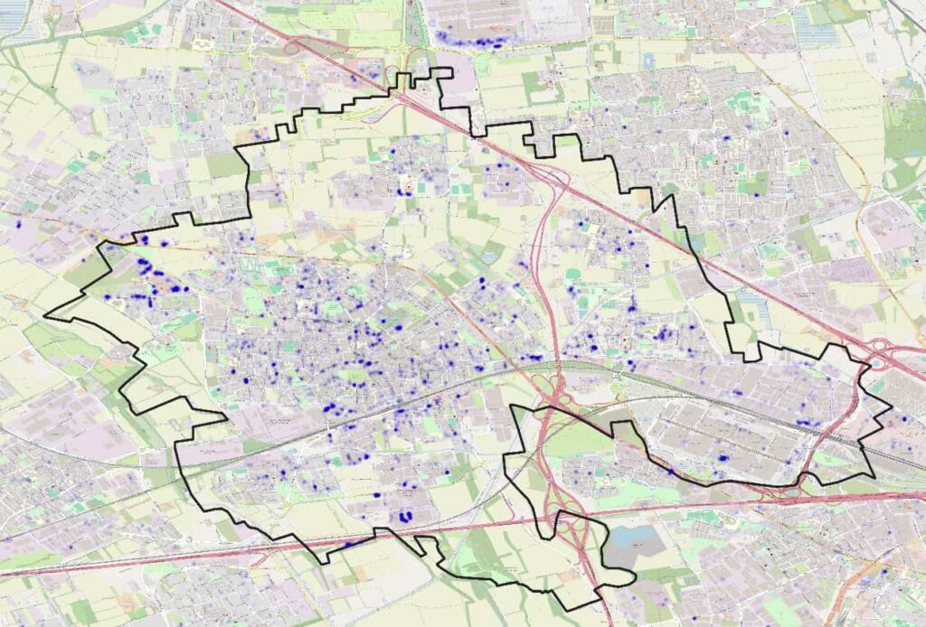
Dataset “O/D Matrix”
Based on either standard or customer defined node definitions, customised “Origin/Destination” Matrixes can be provided with reference to specific geographical areas and timeframes. O/D matrix is one of the most typical tools used by traffic engineers.
Traffic analysis
Analyse road speeds, travel times, and traffic density with our traffic analysis tool, based on historical mobility data. Obtain information on specific areas or routes over a defined period, allowing you to measure how actions impact mobility and understand how seasonality affects incidents or road congestion. Enhance your understanding of real-world conditions through interactive maps and charts. Optimise traffic management, solve mobility issues and integrate traffic data with existing infrastructure and sensors.
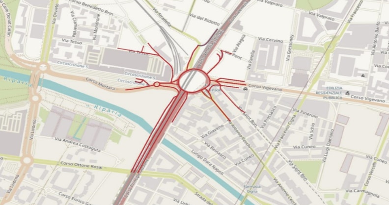
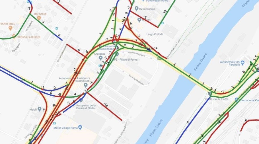
Road segment characterisation
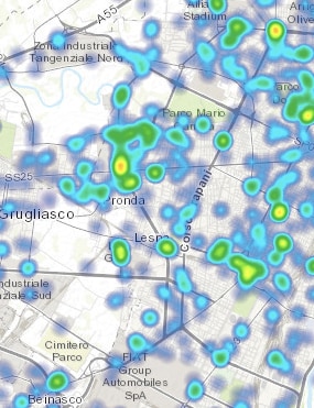
Origin/Destination Analysis
Unlock deep insights into trip dynamics and driver preferences with our Origin-Destination (O/D) Analysis. Visualise trips between regions, identify high-traffic routes, and understand local commuting trends for work or leisure. These insights can then be used to reduce congestion, design efficient infrastructure, support seasonal demands, and drive geomarketing initiatives for a more sustainable transportation network.
Road safety
Telematics, combined with road traffic data, plays a crucial role in identifying and addressing hazardous road areas. The analysis of live and historical driving data alongside traffic patterns, highlights high-risk zones with frequent incidents, abrupt braking or even issues like potholes. Authorities can use these insights to prioritise repairs, optimise traffic management, and implement safety measures, creating a safer and more efficient transportation network.
Learn how our customers made their fleets more efficient, secure and sustainable with Targa Telematics solutions